Earlier this season, I attended the Outfitter and Guide Meeting hosted by the Willamette National Forest Service to stay up to date on special use permits and ongoing projects on the McKenzie River.
One of the most impactful presentations came from district fish biologist Carla, who shared updates on the South Fork McKenzie River Floodplain Enhancement Project—a multi-phase effort led by the McKenzie Watershed Council and aimed at restoring critical habitat and improving river health.
A Look Back: Phases I & II
Restoration work on the South Fork has already made significant progress.
- Phase I (2018): Successfully reconnected over 150 acres of floodplain.
- Phase II (2019): Expanded restoration upstream, reconnecting an additional 20+ acres across a 0.6-mile stretch of river.
These efforts have helped reestablish more natural river flow patterns and improve habitat complexity.
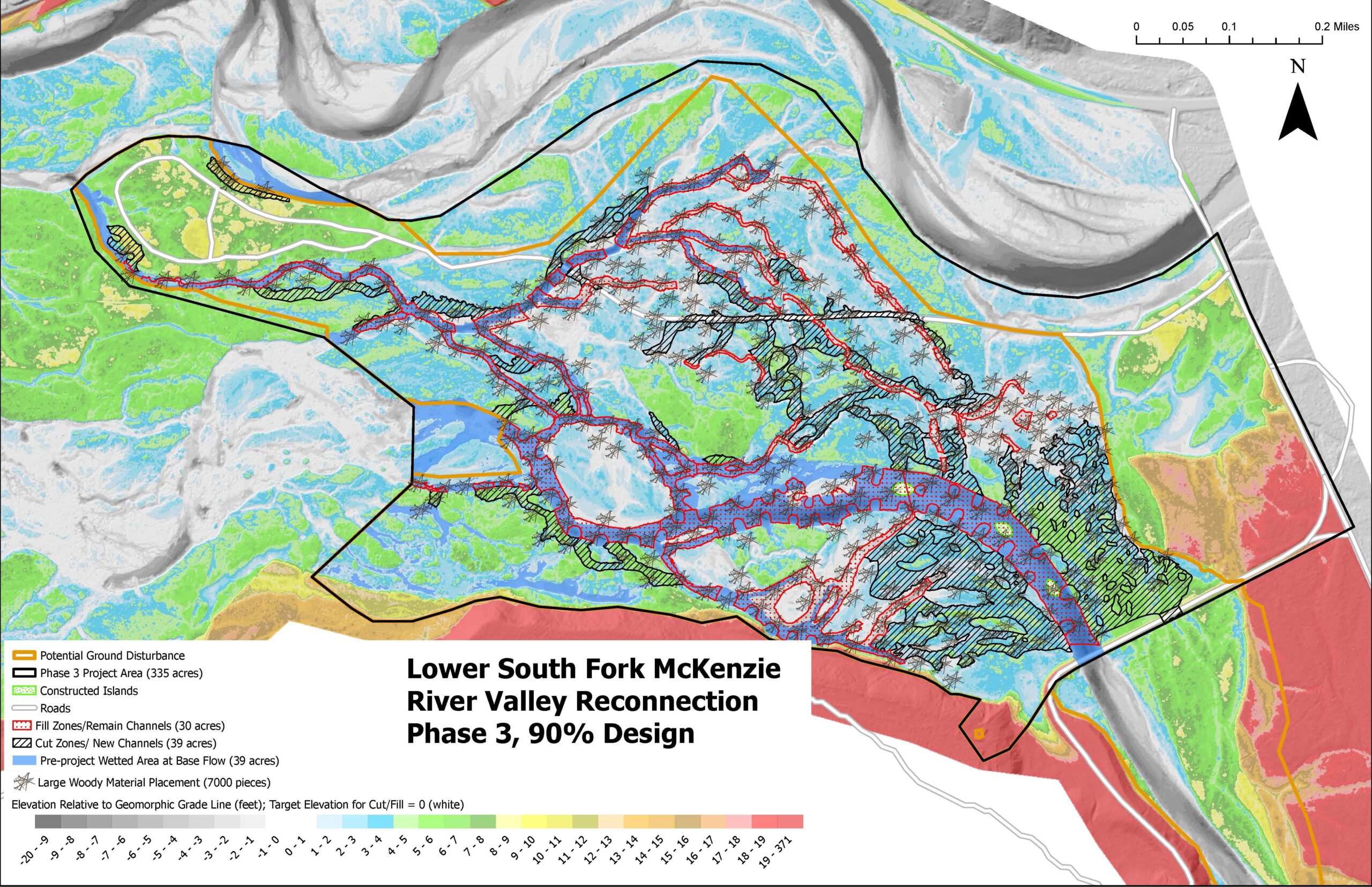
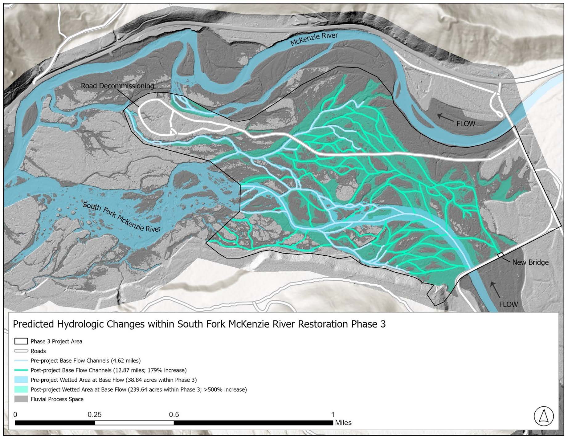
What’s Coming: Phase III (2026)
Phase III is scheduled to take place from May through September 2026, and it represents a major step forward—covering approximately 1,900 acres of restoration.
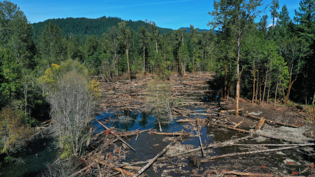
Currently, sections of the South Fork are constrained to a single, incised channel—about 13 feet deep—with large cobble substrate and steep berms. This limits the river’s connection to its surrounding floodplain and reduces habitat quality.
The upcoming work aims to reverse that.
Project Goals
The primary objectives of Phase III include:
- Reconnecting the river to its floodplain
- Improving water quality and substrate conditions
- Increasing resilience to wildfire impacts
- Restoring wetlands
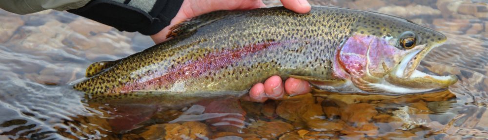
- Enhancing habitat for endangered species, including bull trout and Chinook salmon
How the Work Will Be Done
This is a hands-on, large-scale restoration effort that includes:
- Regrading sections of the river and creating diversion channels
- Filling incised channels to raise the riverbed and reconnect flows
- Carefully collecting and relocating all organisms
- Removing invasive species
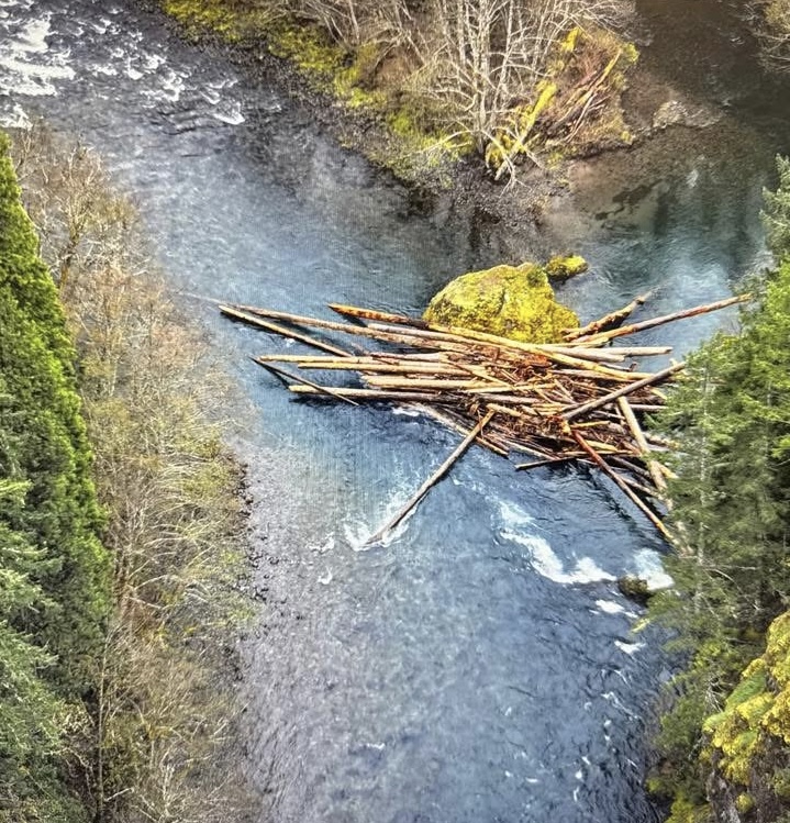
- Placing and anchoring large woody debris and slash to create habitat structure
- Rehabilitating disturbed areas after construction
Why It Matters
For those of us who work and recreate on the McKenzie, this project is about more than restoration—it’s about long-term river health.
A connected floodplain supports better fish populations, improves water quality, and creates a more dynamic, resilient river system. These changes will benefit not only endangered species, but also the broader ecosystem—and everyone who depends on it.